Incan Trails

OMG - what a day! We got up at 3:45 a.m., had our storage bags ready and waiting by the room door, and headed down to breakfast after checking out and putting the bags in the storage room. From there, a warm breakfast with some tea, and we were on our way to the train station. Originally, in order to catch the early train, one would only need to go a few minutes out of town, but the floods of 2010 covered over the tracks for a significant part of the pass, so we headed out to the next town over to catch the 6:59 am train.

Our travel guide gave us the tickets to get to Machu Picchu (hereafter referred to as MP), round trip tickets for the bus to the sanctuary, and sanctuary entry passes. Notice that it wasn’t a round trip ticket for the dome train...needless to say, not thrilled about that! The guide was giving our return tickets to the group leader, who had yet to arrive in Cusco. In fact, the rest of the group wasn’t scheduled to arrive until 6pm today! And I, the youngest in the group, was entrusted the tickets we had...so why couldn’t we have our return passes? It amazes me still. Argh.

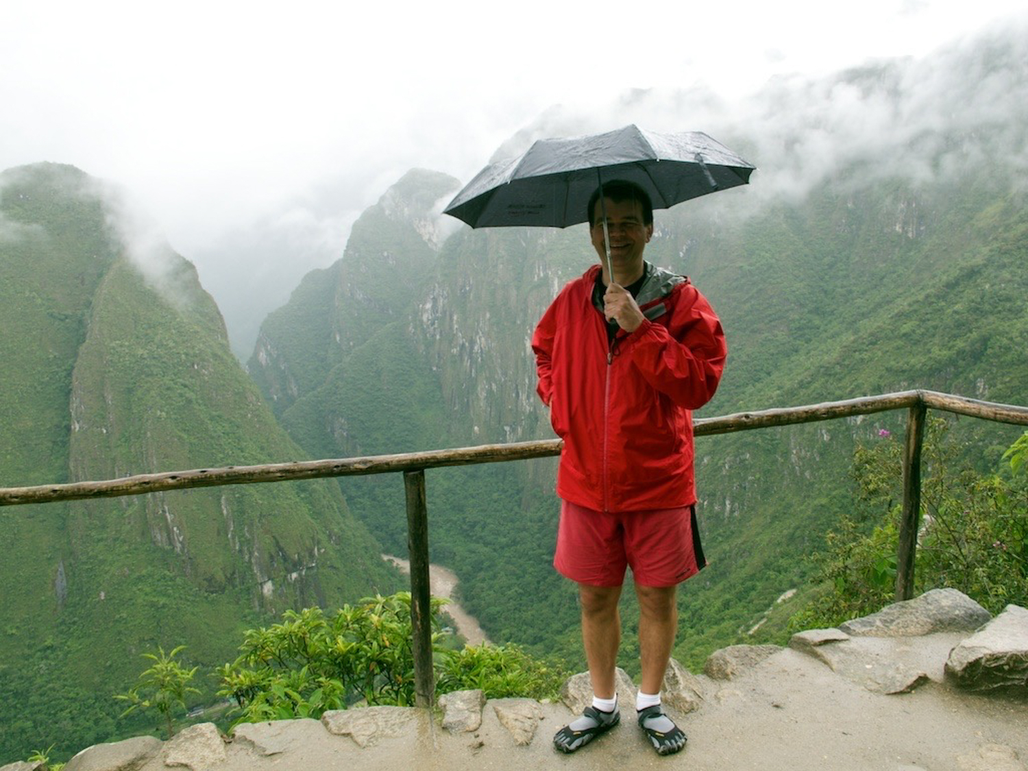
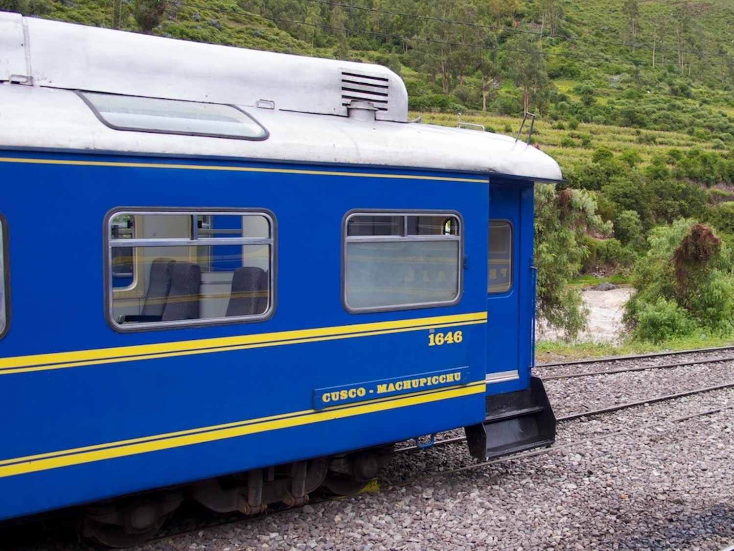
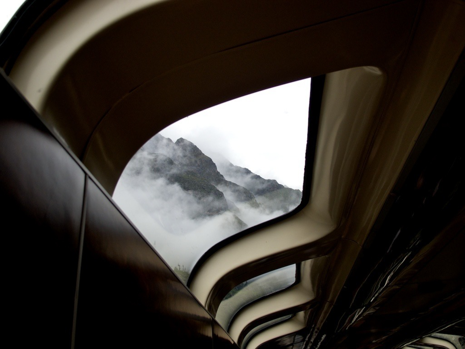
The ride up on the dome train was wonderful - although Randall kept muttering about wifi, and needing it at the hotel in MP. =] The scenery was spectacular, words cannot do it justice. When we arrived in Cusco, we were greeted by our Condor guide, Fredy, who was guiding us on our hike up to MP. Mind you, only Wayne & I did the hike, the others took the bus.

It is a 1200 foot increase in elevation, and about a mile up the hill using the “shortcuts” built. Fredy, typical (aka short and muscular) Peruvian, and Wayne climbed up the stairs (very steep) far more agilely than I. About halfway through, right before the last entry to the shortcut, I broke from the two of them to take the longer, less steep road, and made excellent time, arriving only minutes behind them. I had company, though, a little dog who followed me up the hill. She was with us the entire time! Then, when mi perro and I arrived at the top of the climb, she found a kid leaving a trail of crumbs, and she took off for food. Probably a good thing, because if I had fed her, I might be bringing home a dog. Hiram Bingham wrote about his climb up that fellow climbers “...had a hard time of it and were obliged to stop and rest nearly every 50 feet [I was better than that]. Anyone who has attempted to walk fast at an elevation of 8,000 feet will know how we felt trying to climb at 10,000 feet.”

The weather was perfect climbing up, slightly overcast, and dry. About 5 minutes after I got to the sanctuary, it started raining. Fredy, Jaques, Wayne and I entered the sanctuary, and toured around. My feet were absolutely aching, but I have to say the toe sneakers were great. I didn’t lose a single toenail, and I didn’t fall at all.

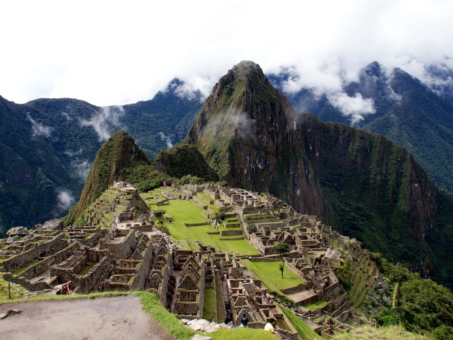
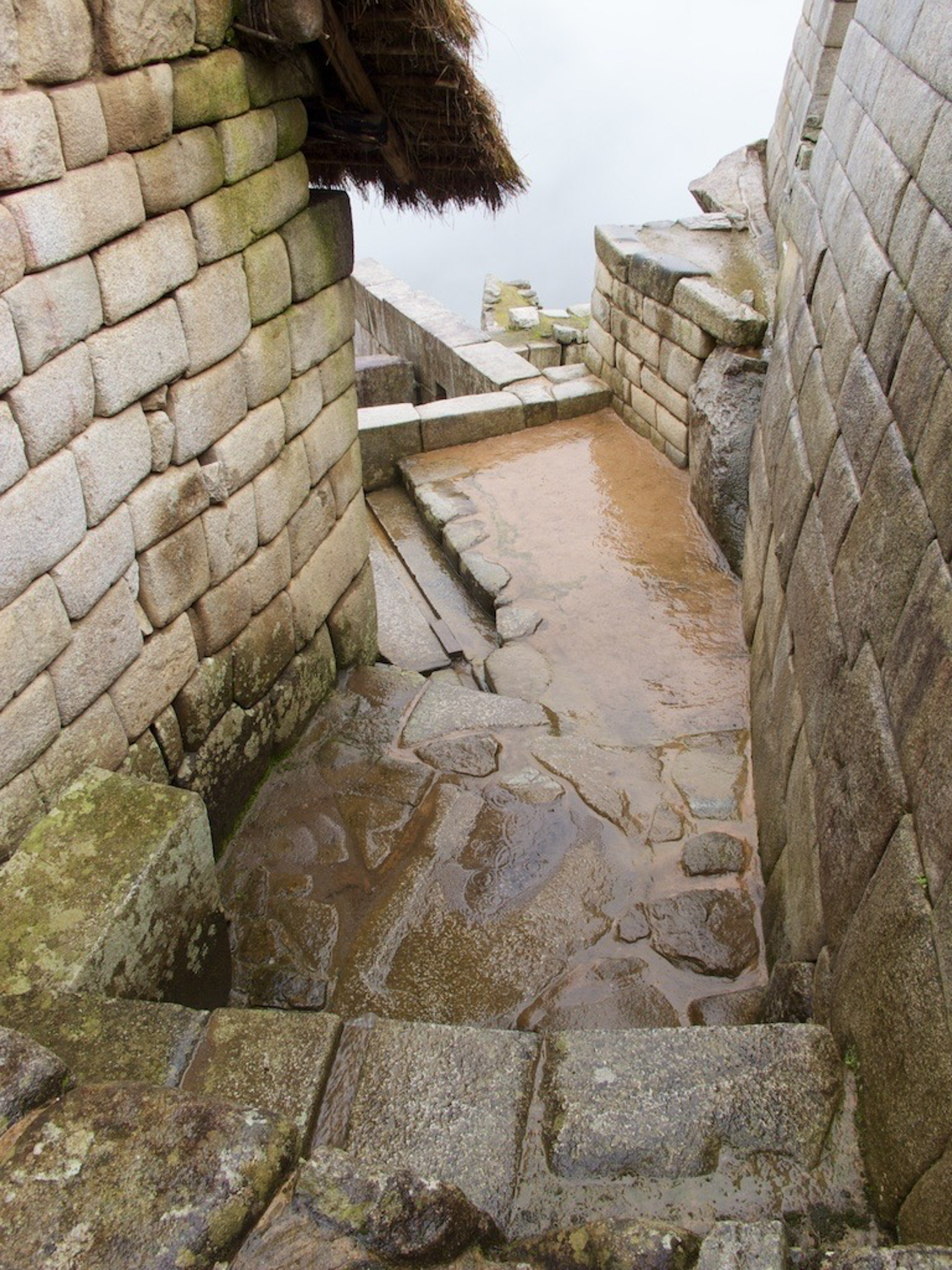
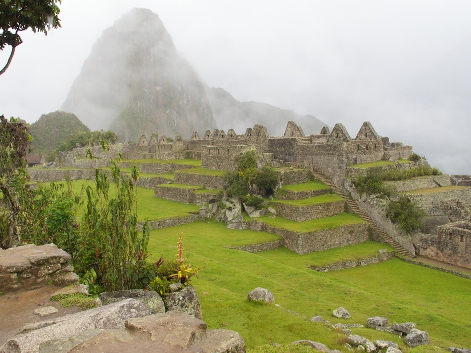
We climbed around the park in the rain for at least two hours, seeing the temples, altars, housing areas, farming terraces, and other general areas. The construction was amazing - built to withstand years of earthquakes and flooding. The stones were all mined from the mountain itself, and the Incas channeled the natural mountain waters into irrigation paths throughout the city. Fantastic, long lasting architecture. As Randall pointed out, sometimes we forget all the advanced learning that was accomplished centuries earlier.

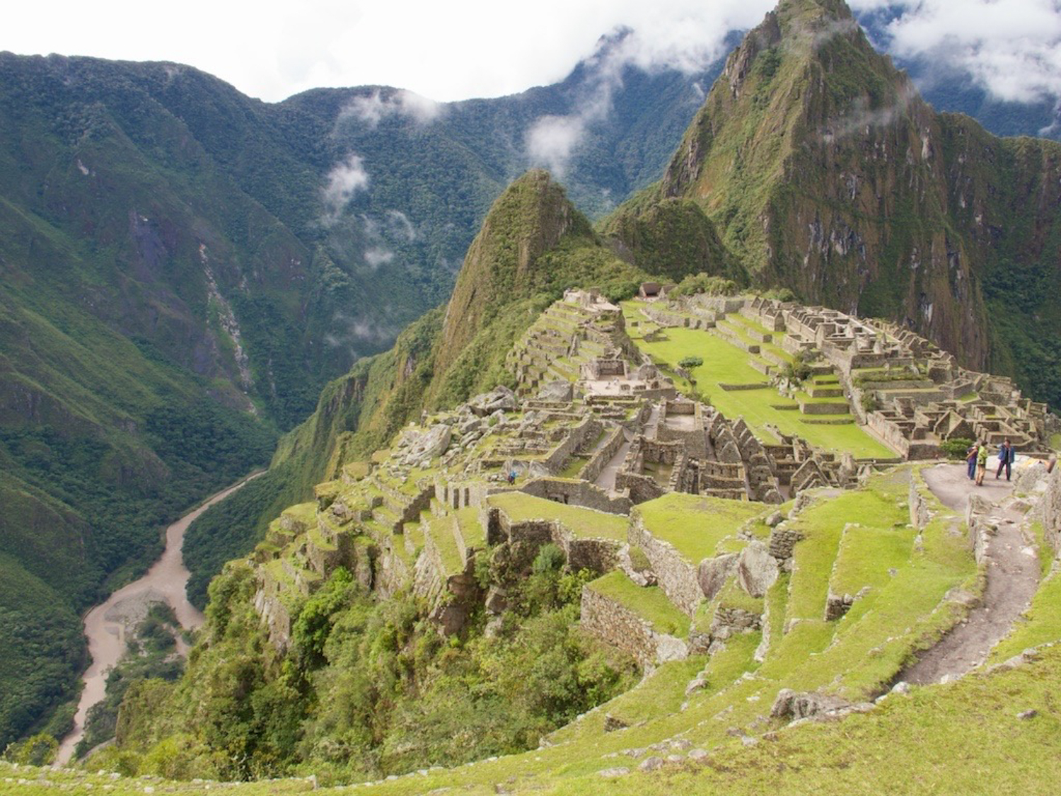
Of the park, Bingham said, “It has the majestic grandeur of the Canadian Rockies, as well as the startling beauty of the Nuuanu Pali near Honolulu, and the enchanting vistas of the Koolau Ditch Trail on Maui...” Couldn’t have said it better myself.

After lunch, we went back into the sanctuary (it had stopped raining) and got a lot of pix. Then down to the downer of the day - our hotel. They put us in a room with two twin beds, despite the fact that we had paid for a “superior” room with one larger bed. When I asked at the front desk, and mentioned that it was coinciding with our anniversary, they did absolutely nothing to help. Boy, was I furious. In fact, I will be letting the arranger of our trip know of my dissatisfaction when I get home.

After that, I went to buy entry to the park so that we can go up tomorrow at sunrise to celebrate our anniversary. Dinner was tasty, at a French/Peruvian bistro in town, but the staff became completely overwhelmed by three large groups, and we were forgotten. Not happy about that one, I’ll tell you. And we were seated behind the entry door, which patrons kept slamming into our table, and leaving open thus letting in all the cold air. I’ll likely not go there ever again, and will stick to Toto’s House or a pizzeria, of which there were plenty!

We are both now exhausted, so it is off to bed for us. Just like Lucy and Ricky Ricardo, except that our feet hang off the ends of our twin beds...

The heights of Cusco

Or, getting there was half the fun...We took the early morning flight out of Santiago to Cusco, transiting through Lima. There were six of us who left before the main group, perhaps an hour and a half earlier. This was quite fortunate for us, as the time to transit Lima customs, and then recheck our bags, was significant. We had a 2 1/2 hour layover, and we wound up getting to the gate with 45 minutes to spare. We waited for the other 31 to arrive, but given their short layover time, we assumed they had been unable to transit the airport in time. So, we got on the plane and headed to Cusco.

Upon our arrival, we discovered that there had been engine trouble in the other plane, they had been sent back to the airport, and the next 3 hours were spent getting another plane and crew for flying. They wound up in Lima unable to make a connecting Cusco flight, and were put up by LAN in Lima for the night.

Side note, if ever in South America, AVOID FLYING LAN!

We arrived in mid afternoon, and took some time in the hotel to re-pack our bags so that they could be stored overnight, and then walked around the city before meeting up with friends to go to dinner. Most of the original buildings built by the Incas are intact, having survived multiple earthquakes thanks to the ingenuity of Incan architecture. The “newer” Spanish buildings have not stood the test of time as well.

Waiting for us at the hotel was a large urn of coca tea, made from the coca leaf, which is also the source for cocaine. Our guide who met us at the station encouraged us all to drink a few glasses of this, as it “aided hydration and adaptation to the elevation,” but warned us not to drink it at night as it would keep us awake. Hmmm. :) The local workers, and the former farmers of Machu Picchu, were and are consumers of the coca leaf itself, chewing it and getting the sap. Bingham “...found it necessary to conform to the ways of the country and provide each workman, the first thing in the morning, with a handful of dried green coca leaves...[and the] employer who fails to provide his Quichua workmen with the daily ration of coca leaves is likely to find it impossible to secure voluntary labourers and very hard to get cheerful efforts from his conscripts.”

One member of our sextet, Randall, was having a very difficult time adapting to the altitude, and stumbled around the city as we went to dinner, muttering as we passed each location that had free wi-fi. And I thought Wayne was bad! Randall’s travel diary must be written on sites to visit based upon wireless access. Perhaps a sip or two of coca tea might have helped him adapt a little more quickly!

Thanks to the two hour time difference between Cusco and Santiago, we ate dinner fairly early, and then headed for an early night to bed, given that we needed to be up and out by 4:45 a.m. in order to catch the dome train to Machu Picchu. Dinner tonight really emphasized why we go on the Mac Geek cruises -- not necessarily to learn more about Mac, but to be with a group of people with similar interests, and to make new friends. Our dinner was at an Indian restaurant, aptly named “Indian Restaurant.” Randall complained about the lack of wi-fi access, I had to run back to the hotel to un-break the safe and get out our Sols, and we set out to enjoy an Indian buffet (except for Randall, who had ventured out for Alpaca meat earlier).

During the dinner, the geek fest was on, in particular focusing on Star Trek. I mentioned that Wayne and I had met Patrick Stewart and the man who played George on Grey’s Anatomy during the Broadway Cares week in NY where they were performing in the short lived Mamet play “A Life in the Theater.” I commented on how short both of them are, and a discussion about height in general as it pertained to Star Trek actors. The conversation then moved towards the merits of which ST was better - the original or ST:NG. NG won, by a landslide, and a number of us started quoting from various episodes. Truly getting the geek on! Wayne just stared and laughed as the fanatics began their quotes. We even started talking about trade shows, and Randall really regaled us with tales from his Super Hacker panels, with alcohol rewards for good questions, and pizza smuggled in at midnight, with discussions going until 4 a.m. Then we started talking about the Big Bang Theory (no, not physics or astronomy, the TV show), and the number of Sci-Fi actors who come on just playing themselves (hello, Wesley Crusher!). Looks like a new series to watch!

Cusco is in southeastern Peru, near the Urubamba Valley of the Andes mountain range. It is the capital of the Cusco region and province, designated the Historical Capital of Peru by the Constitution of Peru, and located on the eastern end of the Knot of Cusco with an altitude of around 11,200 ft. It was the site of the historic capital of the Inca Empire and was declared a World Heritage Site in 1983 by UNESCO.

Many believe that the city was planned as an effigy in the shape of a puma, a sacred animal. Under the Inca, the city had two sectors: the urin and hanan. Each were further divided to each encompass two of the four provinces, Chinchasuyu (NW), Antisuyu (NE), Quontisuyu (SW) and Collasuyu (SE). A road led from each of these quarters to the corresponding quarter of the empire. Each local leader was required to build a house in the city and live part of the year in Cusco, but only in the quarter that corresponded to the quarter of the empire in which he had territory.

According to Inca legend, the city was built by Sapa Inca (which meant leader or king) Pachacuti, the man who transformed the Kingdom of Cusco from a sleepy city-state into the vast empire of Tahuantinsuyu. Archaeological evidence, however, points to a slower, more organic growth of the city beginning before Pachacuti. The city fell to the sphere of Huascar in the division of the empire after the death of Huayna Capac in 1527. It was captured by the generals of Atahualpa in April 1532 in the Battle of Quipaipan. Nineteen months later, Spanish explorers invaded the city.

The first Spaniards arrived in the city on 15 November 1533. Francisco Pizarro officially arrived in Cusco on 23 March 1534, renaming it the "Very noble and great city of Cuzco". The many buildings constructed after the Hispanic invasion have a mixture of Spanish influence with Inca indigenous architecture, including the Santa Clara and San Blas neighborhoods. The Spanish destroyed many Inca buildings, temples and palaces. They used the remaining walls as bases for the construction of a new city. Cusco stands on

layers of cultures, with the old Tawantinsuyu built on Killke structures, and the Spanish having replaced indigenous temples with Catholic churches, and palaces with mansions for the invaders.

Cusco was the center for the Spanish colonization and spread of Christianity in the Andean world. It became very prosperous thanks to agriculture, cattle raising, and mining, as well as the trade with Spain. The Spanish colonists constructed many churches and convents, as well as a cathedral, university and Archbishopric. Just as the Inca built on top of Killke structures, Spanish buildings were based on the massive stone walls built by the Inca. A 1950 earthquake shook the city, causing the destruction of more than one third of the city's structures. Later, the city began to establish itself as a focal point for tourism and began to receive a greater number of tourists.

Since the 1990s, tourism increased, and the hotel sector subsequently expanded. Currently, Cusco is the most important tourist destination in Peru. The city's urban sprawl is still expanding, having extended to the San Sebastian and San Jeronimo districts.

Parting is such sweet sorrow

We arrived in Valparaiso this morning before 6 a.m., surrounded by cranes, dock workers, and many Chilean Navy vessels. It was a fairly smooth arrival, and we waited for our announced time for departure.

Leaving the ship was much more efficiently done as a debarkation process than it had been when leaving the ship to visit any other ports. Guess they were ready to have a little shore leave before heading back to Buenos Aires!

After we grabbed our bags, we boarded a bus and headed out through Valparaiso to Santiago.

As our travel guide told us, Valparaíso is one of Chile's most important seaports and an increasing cultural center in the Southwest Pacific hemisphere. The city is the capital of the Valparaíso Province and Region.

And, although Santiago is Chile's official capital, the National Congress of Chile was established in the city in 1990.

Valparaíso played an important geopolitical role in the second half of the 19th century, when the city served as a major stopover for ships traveling between the Atlantic and Pacific oceans by crossing the Strait of Magellan. Always a magnet for European immigrants, Valparaíso mushroomed during its golden age, when the city was known by international sailors as “Little San Francisco” and “The Jewel of the Pacific.”

Examples of Valparaíso’s former glory include Latin America’s oldest stock exchange, the continent’s first volunteer fire department, Chile’s first public library, and the oldest Spanish language newspaper in continuous publication in the world. The opening of the Panama Canal and reduction in ship traffic dealt a staggering blow to Valparaíso, though the city has staged an impressive renaissance in recent years.

As we made our way to Santiago, we passed several vineyards, to include Concha y Toro. Very nice scenery the whole way there! Unfortunately, once we got into Santiago, there was much construction going on. Our bus driver got completely lost, and the tour guide wound up asking for directions from the street workers, a gas station attendant, and finally a cab driver. As we whizzed through an upscale neighborhood, taking many tree branches with us as the driver drove haphazardly through, we finally made it to Kennedy Avenue, and our hotel.

Santiago, a very smoggy city with its air pollution trapped in the main city due to the surrounding Andes mountains, is the capital and largest city of Chile, and is located in the country's central valley at an elevation of 1706 feet above seal level. Thanks to Chile's steady economic growth, Santiago is now one of Latin America’s most modern metropolitan areas, with extensive suburban development, dozens of shopping centers, and impressive high-rise architecture. It was founded by Spanish Conquistador Pedro de Valdivia on February 12, 1541 with the name Santiago del Nuevo Extremo, as a homage to Saint James and Extremadura. Valdivia chose the location of Santiago because of its climate, abundant vegetation and the ease with which it could be defended—the Mapocho River then split into two branches and rejoined further downstream, forming an island. The Inca ruler Manco Cápac II warned the new rulers that his people would be hostile to the occupiers. The Spanish invaders had to battle against hunger caused by this resistance. Pedro de Valdivia ultimately succeeded in stabilizing the food supply and other resources needed for Santiago to thrive.

The layout of the new town consisted of straight roads of 12 varas (47.1 ft) width, in equal intervals of 138 varas (541.6 ft) perpendicular to each other. With nine roads in the east-west direction and 15 in the north/south direction, there were 126 blocks that formed the so-called manzanas, or square cut.

Lunch was at a local mall, with Kaz, his wife, and Jaques. It was a lovely little Italian place, outdoor seating (unfortunately with smokers, but the air dissipated it a bit) and musicians playing as we ate. Food was great, and copious, and none of us could finish it.

Wayne and I then went on a walking tour of Santiago center, taken directly from the pages of our Lonely Planet guide to Chile. For those who are looking at buying the iPhone or iPad Lonely Planet guides, I advise waiting. They do not quite yet have the formatting down correctly, the maps are broken up poorly, and they omitted the rear index. It made planning for the walking tour a bit difficult.

We got on the subway (Santiago has a wonderful subway system) near the military academy, and headed out to Puente Cal y Canto, where we saw the Estacion Mapocho, the old train station, which is now a cultural center. From there we went to Mercado Central, where there was a nice walkway, and closed off to cars. From there we went to the Plaza de Armas, and then headed to the Ex-Congreso Nacional and Tribunales de Justicia. The architecture was stunning, and again there was a mix of the classical with modern. I much preferred the classical!

On from there we went to the Plaza de la Constitucion, where there is a statue of President Salvador Allende, who was murdered during the CIA backed 1973 coup inside the presidential palace, Palacio de la Moneda. Beyond the palace was the Plaza de la Ciudadania, marked by a HUGE Chilean flag, and the Alameda, which we took to Cerro Santa Lucia, which provided beautiful views of the city.

From here, we returned to our hotel via the subway, and had a pleasant dinner at a steakhouse (Wayne ordered salmon!) with Ivan and Sue before we all headed out on our own ways. Very pleasant time, and we really enjoyed seeing them again. I am very glad that they have booked on the Germany cruise, and that we will continue to travel together.

An early bed after a commemorative pisco sour with Don McAllister, in preparation for the morning’s travel to Peru.

Puerto Montt, last port of call

Happy Valentine’s Day, all!

Today finds us at Puerto Montt, Chile. This village markes the offical end of the Lake District of Southern Chile. Although founded in 1853, it wasn’t until 1912, when it was connected by rail, that it became the contact point for the rest of the south. It has been known for years as “the end of the line,” whether traveling by railway, dirt road or highway. For the most part, it remains so to the present day. Puerto Mont is also the starting point for the many tourists that arrive to visit the famous Lake Llanquihue to the north (we didn’t go there), one of the most visited sites in all of Chile.

The Lake District’s unofficial boundary is the Bio Bio River. South of the river, earth and water form a series of blue lakes that reflect ice capped volcanoes and ancient trees. The Andes tower above it all, and leave no question why Mapuche fought Inca and Spaniard to defend it. The district is named for its 12 largest glacially carved lakes, but it also has dozens of smaller lakes as well. Rivers and streams link to some of Chile’s richest freshwater fishing grounds. Six volcanoes line the district’s center, with Villarica, it’s highest, reaching more than 9000 feet in height. To the east there are four passes leading across the Andes into Argentina.

Puerto Montt is the region’s capital and largest city. It is the terminus for the railway and continental portion of the Pan American highway, which is a series of national scenic highways that stretch more than 16,000 miles from Alaska to the southern tip of Chiloe Island. The city itself was founded on February 12, 1853, after government-sponsored immigration from Germany that began in 1848 populated the region and integrated it politically to the rest of the country. It was named after Manuel Montt, President of Chile, Puerto Montt has a large German community, as the colonists first arrived in 1852. With a presence of about 130,000 people, their influence is seen in the architecture within the city. The redwood cathedral built on the main plaza is the oldest building in the town, dating to 1856.

The facade of Puerto Montt is quite appealing, especially from the sea. Unfortunately, when you arrive in town, you are overwhelmed by a sense of oldness, tiredness, and disrepair. The newer, consumer focused buildings are modern and bright, but the historic architecture is in disrepair, and a shadow of what they must have been earlier in time. Blessedly, the most breathtaking part of the view - the Andes mountains, some of which you can see above, is unmarred from this distance, and unaffected by any air pollution. As we walked along the jetty front, there was an exercise park which was actively being used by many people, a number of statue parks that were overcome by graffiti, and a railway memorial consisting of a steam engine and caboose, along with a mock train station. We spent two hours walking around the city, but were glad to make our way back to the ship.

One more day at sea, and then we disembark, headed to Machu Picchu. I’m relatively positive we will be off line those days, so do not expect to hear from us until we arrive in Houston on the 22nd!

It's flippin' cold here, Mr. Bigglesworth!

It is now 1:11 pm, and the temperature has risen to 51 degrees - finally - after being in the freezing fjords. Wayne expressed his feeling of chill hatred in the cabin, wearing his Patagonia jacket as we go through the Patagonian Fjords to Puerto Montt.

Our first part of the two days of cruising was up the Strait of Magellan as we were leaving Punta Arenas. The strait comprises a navigable sea route immediately south of mainland South America and north of Tierra del Fuego. The waterway is the most important natural passage between the Pacific and the Atlantic oceans, but is considered a difficult route to navigate because of the unpredictable winds and currents and the narrowness of the passage. The strait is about 350 miles long and about 1.2 miles wide at its narrowest point.

There is also a Coastal and Marine Protected Area (the Francisco Coloane region) which serves as a sanctuary for Humpback whales.

Ferdinand Magellan, a Portuguese sailor in service to the Spanish king, became the first European to navigate the strait in 1520, during his global circumnavigation voyage. Because Magellan’s ships entered it on November 1st, All Saints’ Day, it was originally named Estrecho de Todos los Santos (Strait of All Saints). Later, the Spanish kin changed the name in honor of Magellan. Other early explorers included Francis Drake, Phillip Parker King, and FitzRoy of the HMS Beagle.

Chile took possession of the channel in 1843, with the first settlement at Fuerte Bulnes, in a forested zone on the north side of the strait. This was abandoned, and in 1848, the city of Punta Arenas was founded where the Magellanic forests met the Patagonian plains.

Until the Panama Canal opened in 1914, the strait was the main route for steam ships traveling from the Atlantic to the Pacific. It was considered the only safe way to move between these oceans, as the Drake Passage was notorious for turbulent and unpredictable weather.

Much of what has been presented at our Mac classes for the last two days has been pretty much old hat for the two of us, so we’ve taken to amusing ourselves onboard ship. I have continued with my morning exercise classes, along with “Boot Camp,” which has been effective enough to make me want to take classes when we get back to Hawaii. Sue has been there with me for that all the way. There has also been a mixology class, a Puerto Montt discussion, and trivia. Mom would make a killing here. And I have personally subsidized the pay of almost every technician in the spa -- I love to get pampered. I have decided that since we have a spa about 1 mile down the road from our house, I am going to book a facial and massage on the second Sunday of each month. I shouldn’t wait a year between treatments! It has made for a very relaxing 2 days.

We’ve finished our Mac classes for the day, and are planning on lazing around a bit today. I’ve assembled a bunch of post cards that will be uploaded and mailed when we hit Puerto Montt and better wifi tomorrow. In another hour, I will head up to the gym for my last Boot Camp session and a little extra cardio. I saw the menu for dinner tonight, and I think I need to have a few negative calories to appreciate it fully!

Tomorrow is Puerto Montt, then one final day at sea, and then, alas, the cruise is at an end. We will head to Cuzco, hike Machu Picchu, and then it is all over and done. I am not looking forward to ending the vacation, but there are three little (figuratively) kitties waiting at home, and we are looking forward to seeing Darien before she heads to Costa Rica.